From surf zone to full ocean depth high resolution bathymetry, 2D HR&UHR seismic, sub-bottom profiling, side-scan sonar and magnetometry for a complete image of the seafloor.
AD Geoscience's marine geophysical survey capability covers the full range of acoustic and electromagnetic methods required to characterize the seafloor and its sub-strata. From shallow nearshore environments to deep offshore basin surveys, we deploy calibrated sensor systems aboard our specialized vessel fleet.
Key Applications
- Pipeline Route Surveys
- Platform Site Investigations
- Cable Route Surveys
- Renewable Energy Site Surveys
- UXO Pre-Screening
Marine Geophysical Survey Capabilities
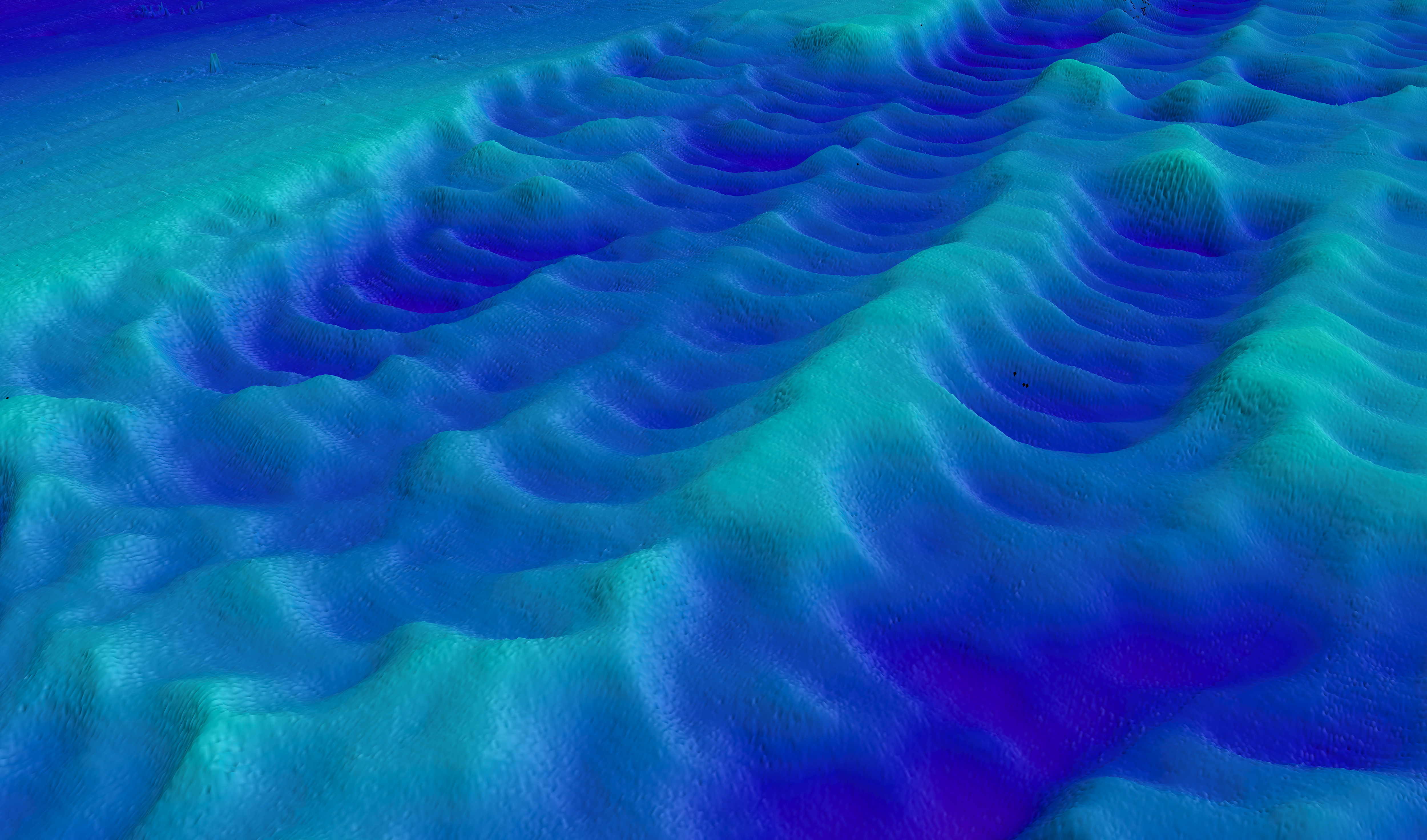
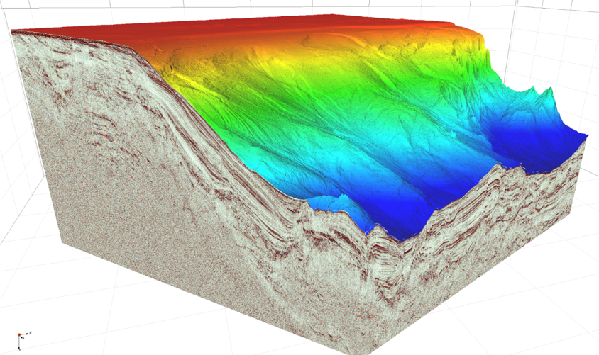
High Resolution Multibeam Bathymetry
Full coverage seafloor mapping providing accurate water depths and seabed morphology using state-of-the-art multibeam echo sounder systems.
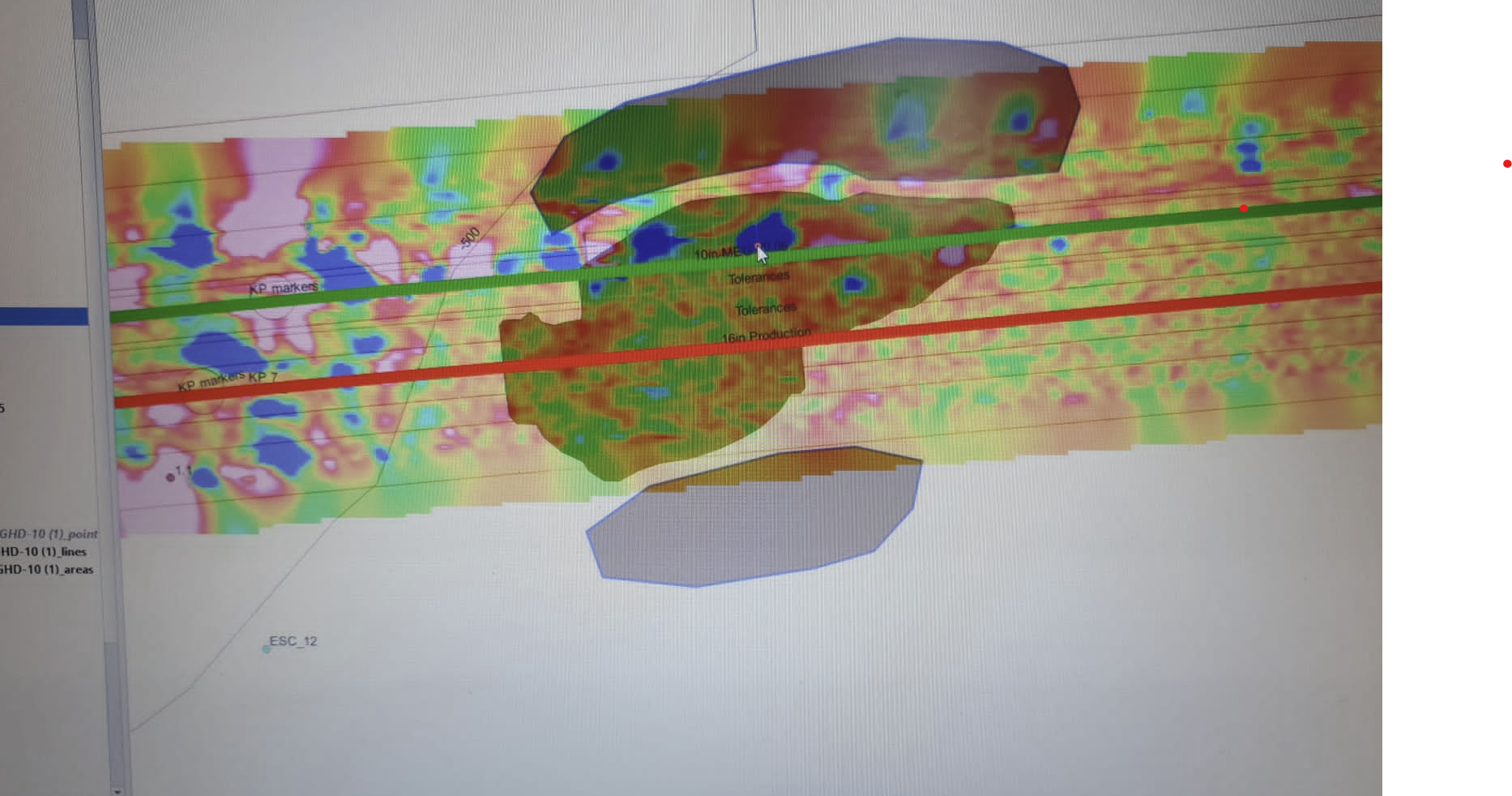
2D HR & UHR Seismic
High and ultra-high resolution seismic acquisition revealing sub-surface stratigraphy and geological features critical for pipeline and infrastructure routing.
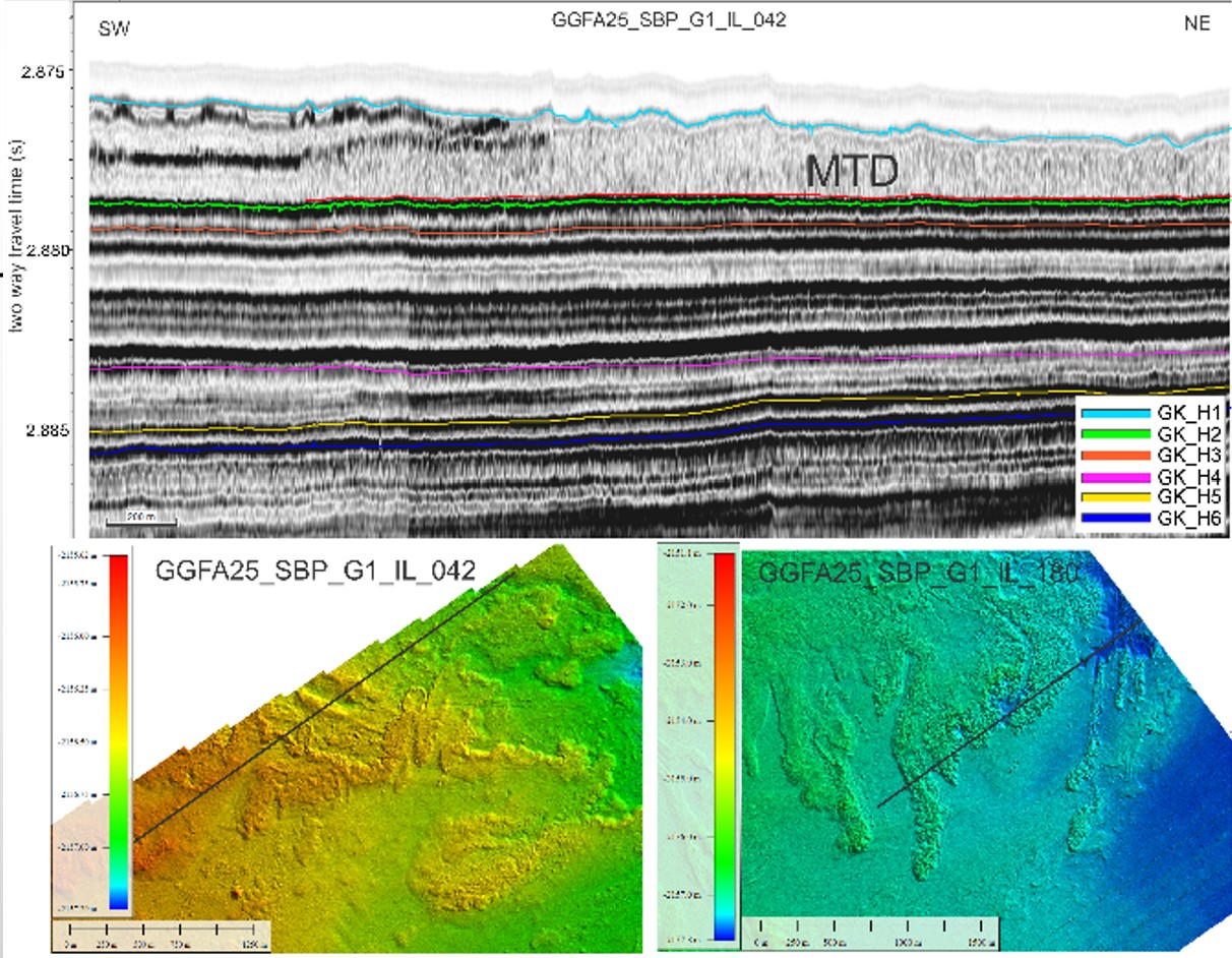
Sub-Bottom Profiling
Parametric and chirp SBP systems delivering high-resolution acoustic imagery of shallow sediment layers for engineering foundation assessments.
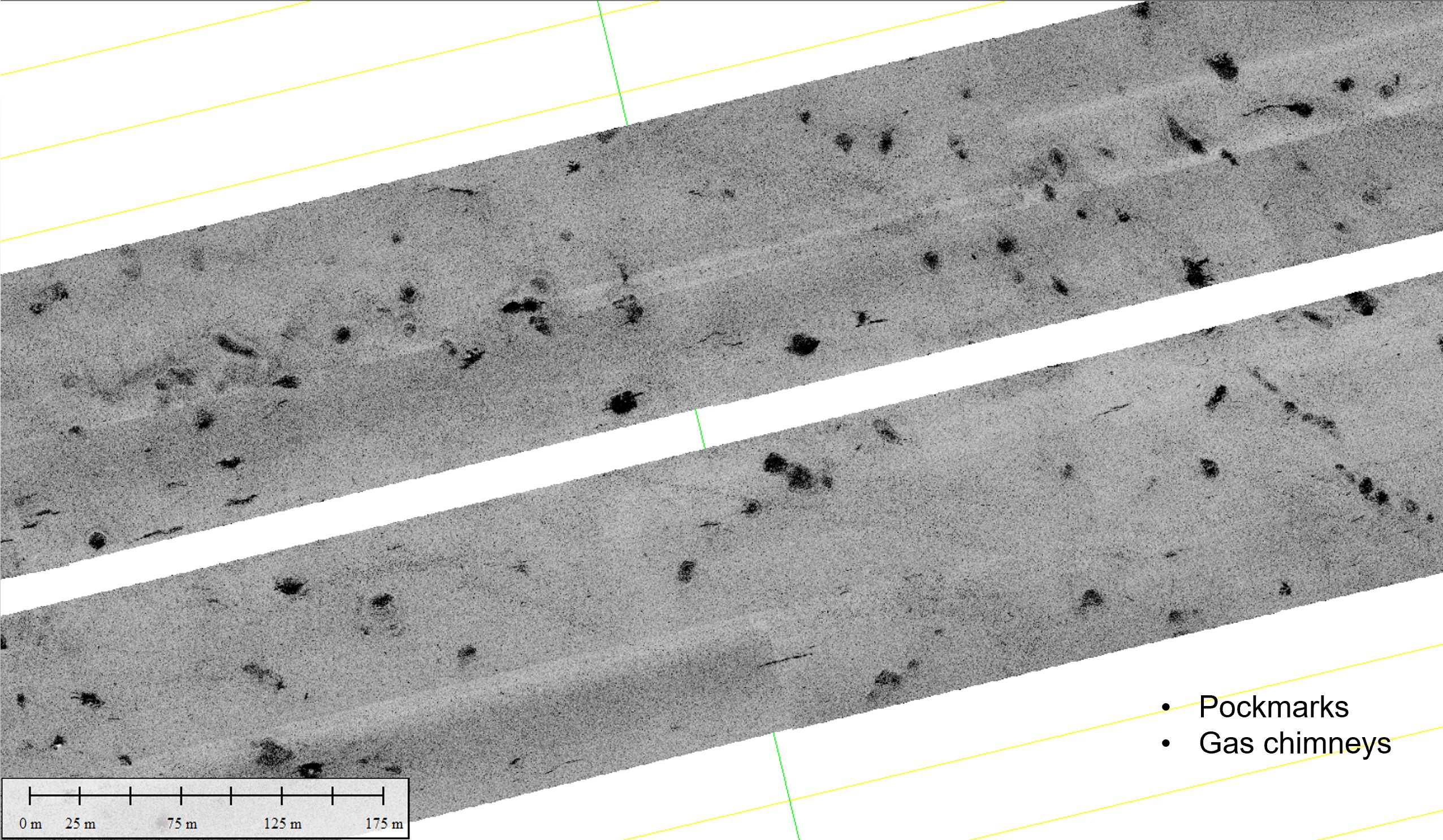
Side-Scan Sonar
Towfish and hull-mounted SSS systems providing photographic-quality seabed imagery to identify features, hazards, and man-made objects.
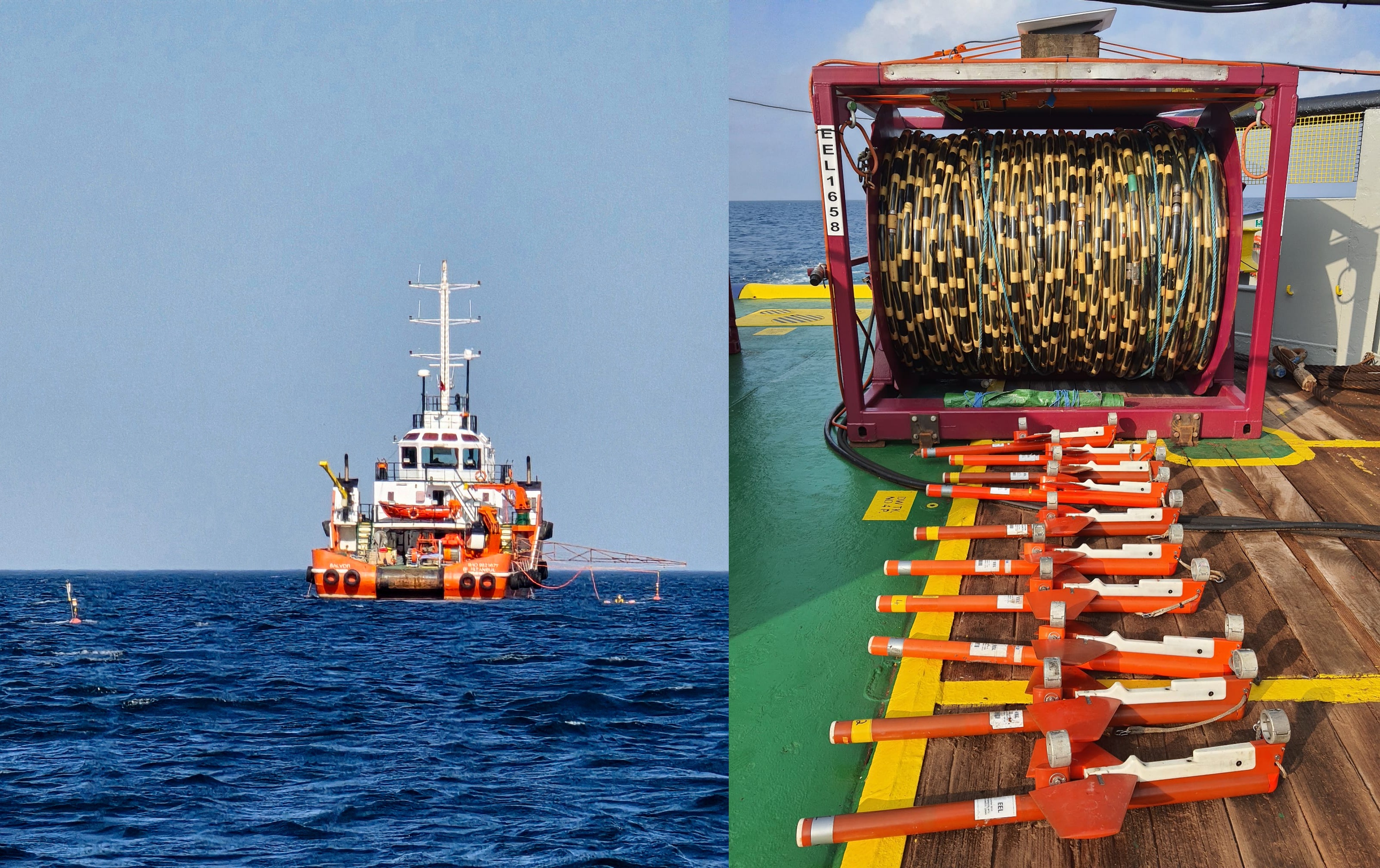
Magnetometry
Towed and integrated magnetometer systems for detection of metallic objects, pipeline verification, and UXO risk screening.
Related Services
Combine with these services for comprehensive integrated surveys.
Require Marine Geophysical Survey?
Talk to our survey team about your project requirements.
Get in Touch